Lesson 1:
The British Empire and colonial ‘others’

LESSON OBJECTIVES:
Upon completion of this lesson, students will be able to:
1. Distinguish between soft and hard power
2. Analyse Britain’s use of power to maintain control in the Empire and at home
Hard and Soft Power
Political scientists and historians sometimes talk about two different types of power, hard power and soft power. To define these simply, hard power is enforcing law and order through military, legislative or economic power, while soft power is using less direct means of maintaining order and dominance, such as through educational or cultural means. A parent might enforce a household rule such as turning the lights off through withholding pocket money from a child who left the lights on; this is an example of hard power because it is enforcing through economic means. Alternatively, the same parent could teach the child about the environmental impact of wasting electricity; this is an example of soft power because it is encouraging the child through education instead of force to take a particular view.
Quick Quiz: Which of these represents soft power?
A. A children’s presenter sings a song about conserving electricity on a television programme.
B. Lawmakers pass a law saying that households can only use an hour of electricity every day.
The British Empire in the Victorian period covered territory in North America, South America, Africa, Asia and Australia, as well as Europe (Gibraltar and Ireland, for example). Because it was the biggest empire ever seen up to that point in time, Britain had to use both hard and soft power to maintain it. Look at the painting below, and see if you can see evidence of hard and/or soft power.
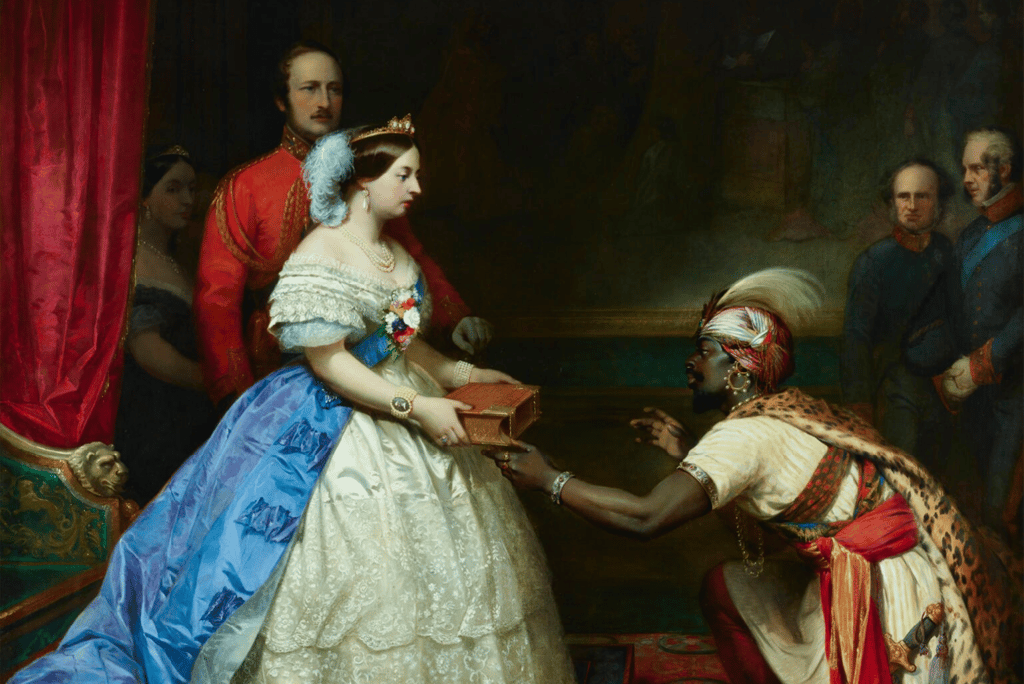
Thomas Jones Barker, “The Secret of England’s Greatness,” 1862-3, image in the public domain, original painting in the National Portrait Gallery, London.
Barker painted this artwork after The British Workman, a magazine for working people, published a story entitled ‘Queen Victoria and the Bible’ (1859). In the story, an unspecified African ambassador asks the queen to tell him the secret of England’s greatness. Victoria, the story indicates, “did not…show the ambassador her diamonds and her jewels, and her rich ornaments, but handing him a beautifully bound copy of the Bible, she said, ‘Tell the Prince that THIS IS THE SECRET OF ENGLAND’S GREATNESS’” (p. 237).
Discussion question: Does the story and painting about England’s greatness use soft power or hard power or both to maintain Britain’s position in the world? How do you know?
Teaching Empire
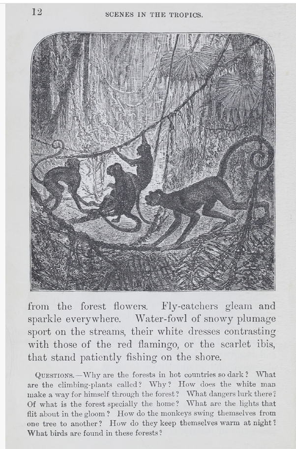
As “The Secret of England’s Success” shows, Britain had to educate about the value of empire to people in Britain and the colonies. Britain sent textbooks to students throughout its empire, and these textbooks gave readers messages about the empire and Britain’s place in it. Look at the following pages from The Royal Readers, a series of reading texts that went out to children in Britain and in the colonies. The first is from book one, and the second is from book four in the series.
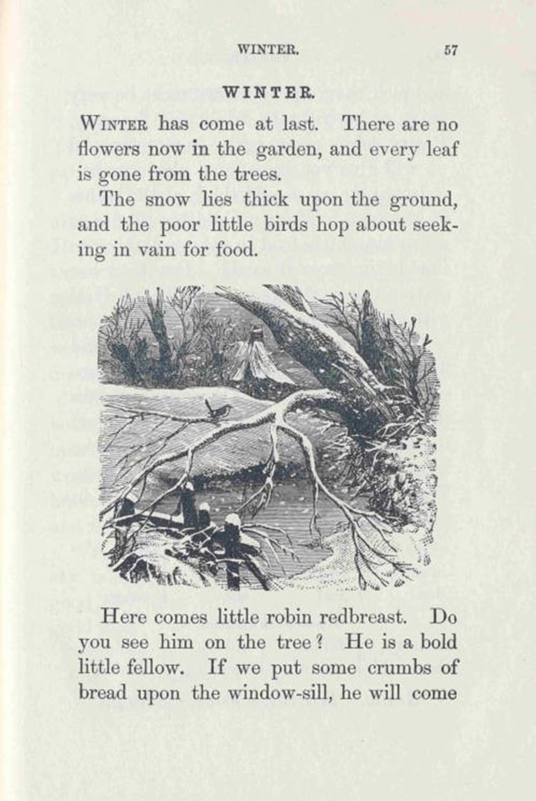
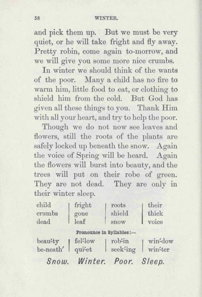
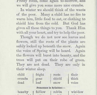
Royal Readers Book 1 (1916 version)
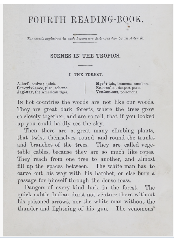
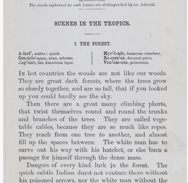
Royal Readers Book 4 (1887 version)
Discussion Question: What do these two stories tell you about what British school texts thought was important? What do they tell you about who/where is ‘civilized’ vs. ‘uncivilized’ and how do you know? How might a reader in Britain experience these stories differently than a reader in Jamaica?
Writing Assignment:
Take a look at the following map published in the British popular magazine, The Graphic, in the 1880s, and designed by the British children’s book illustrator, Walter Crane:
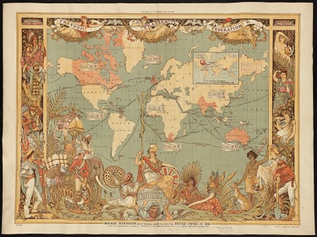
Walter Crane, “Map of the Imperial Federation,” Supplement to The Graphic July 1886, image in the public domain.
What does this image tell you about how Britain saw its place in the world? What evidence can you find of power hierarchies and ideas about who is civilized? Describe how the map displays elements of hard and soft power.
Bonus question: What does the map tell you about gender roles?